TAMPA, Fla. (WFLA) – After a few quiet weeks, activity in the tropical Atlantic is starting to pick back up. The National Hurricane Center is now monitoring three separate areas in the tropics but thankfully none are of any concern in the short term.

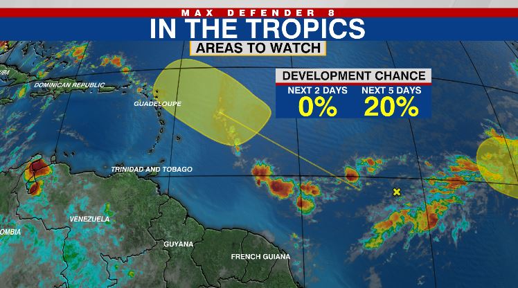
One tropical wave in the central tropical Atlantic now has a 20% chance of development over the next five days. Conditions will become more favorable for development over the weekend and into early next week as the disturbance moves near the Lesser Antilles.

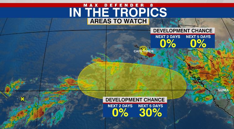
Another tropical wave is forecast to emerge off of the west coast of Africa by Thursday night. Slow development of this disturbance is possible over the next several days with a 30% chance of tropical formation.
Additionally, the NHC is monitoring a tiny area of low pressure near the Cabo Verde Islands that is no longer expected to organize into a tropical system. Locally, heavy rain is expected with this disturbance in the Cabo Verde Islands through Wednesday.
This ramp-up in tropical activity is to be expected here in August as we move closer to the statistical peak of hurricane season on Sep. 10. The “Main Development Region” in the tropical Atlantic between the Lesser Antilles and the west coast of Africa is the primary area for development through the peak of hurricane season. On average, more than 60% of all tropical systems form in August or September.


