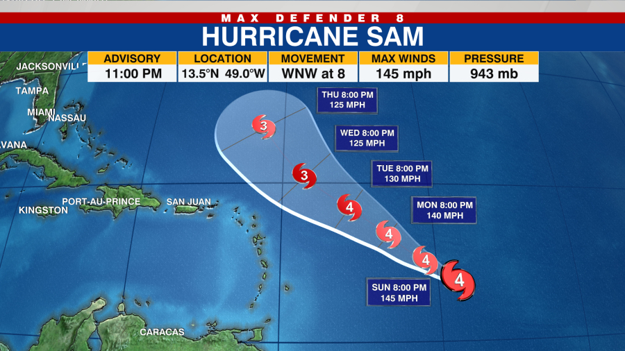
TAMPA, Fla. (WFLA) —Hurricane Sam strengthened from a Category 3 hurricane to a major Category 4 hurricane early Saturday evening, and continues to strengthen rapidly in the Atlantic, the National Hurricane Center said.
At 11 p.m. ET Saturday, Sam was about 990 miles east-southeast of the Northern Leeward Islands with maximum sustained winds of 145 mph and hurricane-force winds extending outward up to 30 miles from the storm’s center. It was moving west-northwest at 8 mph.
“This general motion is forecast to continue through Sunday. A turn toward the northwest is
expected on Monday,” the hurricane center said. “Fluctuations in intensity are likely into early next week.”

Swells generated by Sam are forecast to reach the Lesser Antilles early next week and have the potential to cause life-threatening and surf and rip current conditions, according to the hurricane center.
No coastal watches are warnings are in effect.
Meanwhile, Teresa weakened to a remnant low in the Atlantic Ocean on Saturday. The system is expected to dissipate Sunday morning. There are no coastal watches or warnings in effect.
The hurricane center is also monitoring an area of disorganized showers and thunderstorms associated with the remnants of Peter several hundred miles south of Bermuda. The system has a low 20% chance of developing into a tropical depression over the next five days.


