TAMPA, Fla. (WFLA) — The tropics are active right now with three areas to watch.
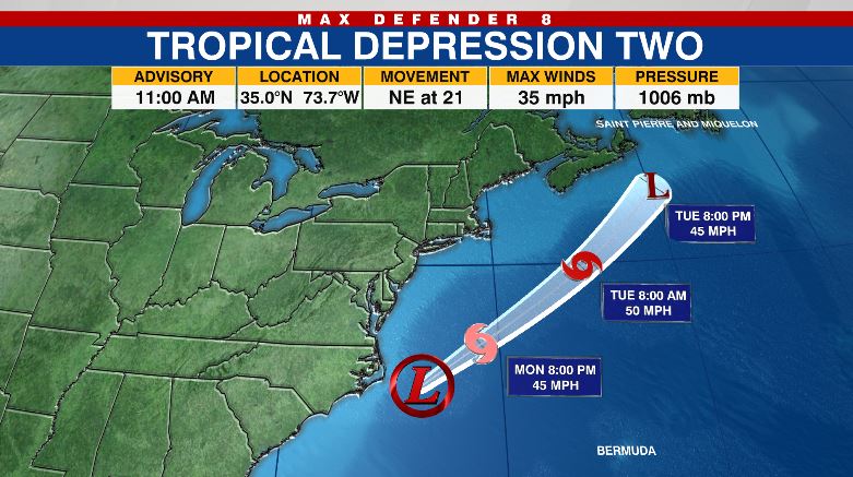
Tropical Depression Two has formed off of the North Carolina coastline. This system is expected to intensify into Tropical Storm Bill at some point later today eventually becoming the second named storm of the 2021 Atlantic season. Thankfully, Tropical Depression Two is heading away from the U.S. coastline and is not a threat to land.
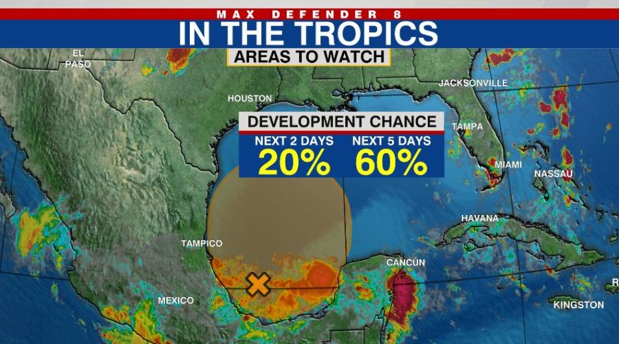
The next area of concern is in the southern Gulf of Mexico. A broad area of low pressure may organize in the Bay of Campeche during the week. That system should drift north toward Texas and Louisiana later this week. The moisture and rain associated with it should stay west of the state of Florida.
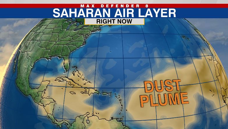
Saharan dust is spreading across the Atlantic Ocean, and it makes it to Florida by the end of the week. This dust should limit rain chances Friday and Saturday as well. The tropical moisture stays to the west and eventually north of Florida.
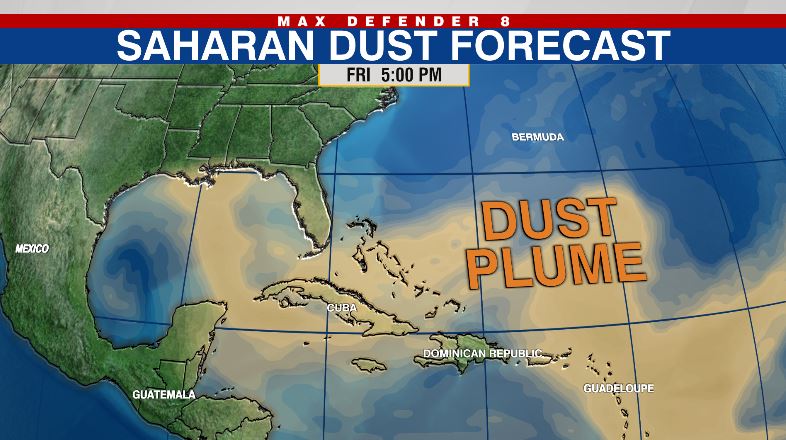
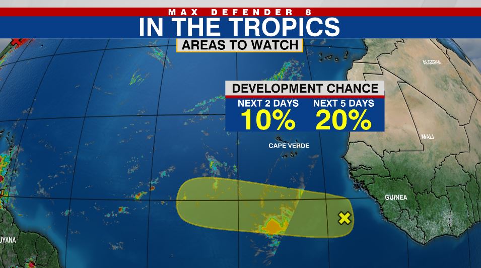
The Saharan dust will also limit the development of the third tropical wave coming off Africa. As the cluster of thunderstorms begins to organize early this week, it will pass into the dry, dusty air and the development should falter.