TAMPA, Fla. (WFLA) – Today was gloomy and mild, with temperatures hovering in the 70s. Tonight will be cloudy and mostly quiet, with temperatures cooling into the upper 60s.
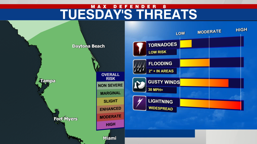
We are waking up to showers and storms pushing onshore from the Gulf. We have the possibility of heavy downpours and lightning, along with gusty winds. A severe thunderstorm is possible and the possibility of an isolated tornado cannot be ruled out.
Currently, the entire Tampa Bay area is under a “marginal” risk of severe weather with this system. That’s basically a one out of five on the threat level, so be on the look out for some stronger wind gusts and brief heavy downpours.
If you’ve been hoping for chillier temperatures- you are in luck, just in time for Christmas! The cooler air arrives behind the front. We stay in the 60s Wednesday afternoon with a cool, refreshing breeze all day.
Thursday we wake up in the chilly low 50s and we warm into the upper 60s and low 70s under mostly sunny skies.
Christmas Eve starts out chilly, in the mid to low 50s and warms into the mild mid 70s under mostly sunny skies.
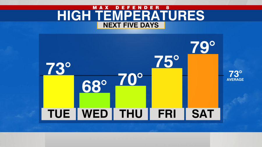
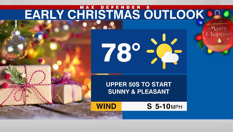
Christmas Eve and Christmas Day look quite comfortable with highs in the mid-upper 70s with lots of sunshine and nice (low!) humidity.