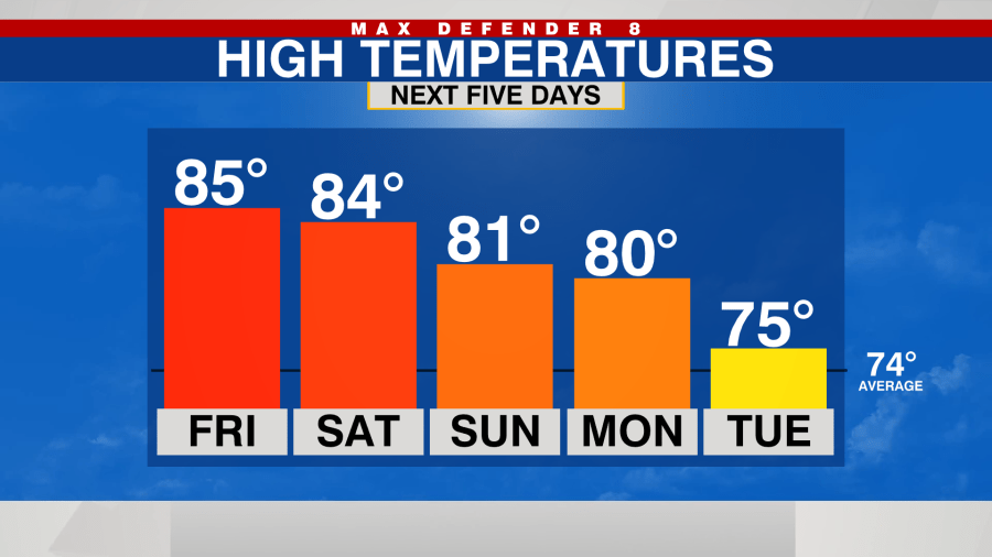
TAMPA, Fla. (WFLA) — Temperatures were warm again this afternoon and tied the record high of 85° at the Tampa International Airport. It’ll be a comfortable evening with temps falling into the upper 60s by Friday morning.
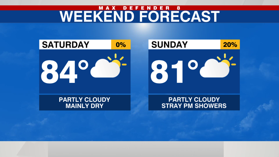
With the exception of a few isolated sprinkles, it’ll be dry this evening and stay mostly dry through Saturday. With it staying dry, temperatures will stay warm with highs in the low to mid-80s.
Rain chances increase to a 20% for Sunday and Monday with a few scattered afternoon showers possible but it will still be warm.
A strong system will develop in the Gulf early next week and pass over the state Monday night into Tuesday with a chance for heavier rain and even some thunderstorms.
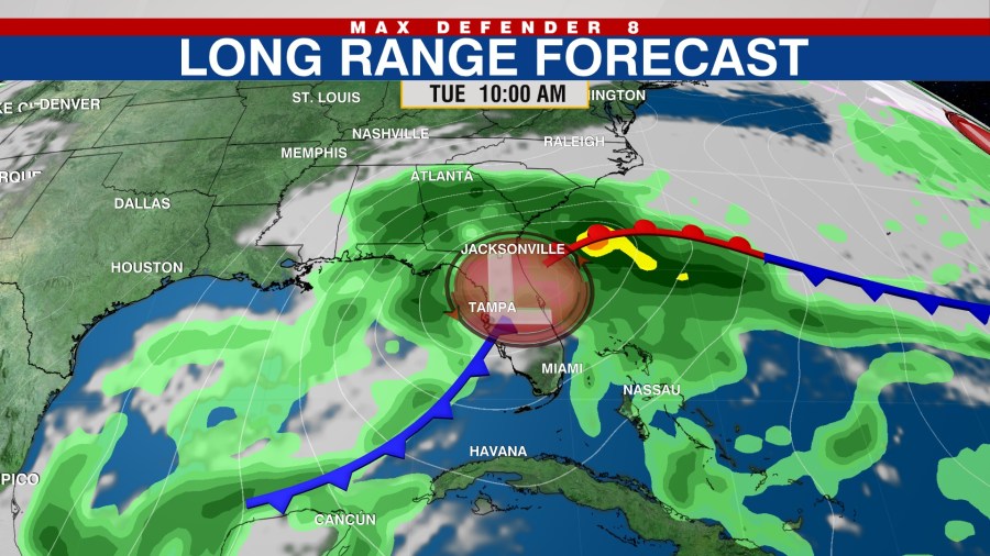
Temperatures will turn cooler behind the system with highs in the low to mid-70s and low temps in the upper 50s through the middle and end of next week.