TAMPA, Fla. (WFLA) – Another day with record-breaking temperatures in the forecast. Highs should reach the mid 80s, and the record high is 85 today.
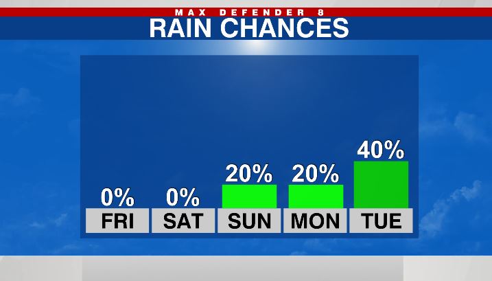
We’ll see a few passing clouds through the day, but rain chances are less than 10%. With the April-like temperatures, it will be a great day to head to the beach or blast the A.C. while you’re baking for the holidays.

It slowly cools down this evening with lows in the mid 60s. We are warm again on Saturday with highs in the low to mid 80s, which is still close to the record high of 84 tomorrow. Once again, we stay mostly dry.
There is a 20% chance of showers on Sunday as a front arrives and stalls just our north. Highs still reach the low 80s. An area of low pressure develops in the Gulf of Mexico on Monday, so the rain chance remains at 20%. Finally, a cold front slides through the area on Tuesday with a good chance for showers and even a few thunderstorms.
Behind that front, winter air returns. That’s convenient because winter officially begins on Tuesday at 10:59am. Highs will be in the low 70s through the end of next week.