TAMPA, Fla. (WFLA) – We warmed up into the low 80s today under partly cloudy skies. A weak front is stalling out to the north of us, and a few isolated showers are making their way onshore, particularly to the north of I-4. Expect a mild evening, slowly cooling down into the upper 60s overnight with patchy dense fog forming.
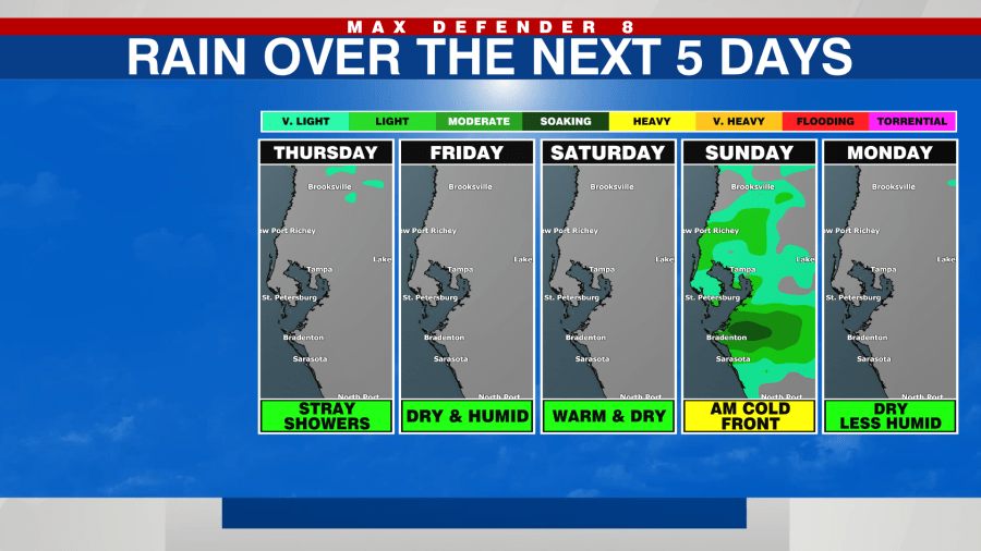
Thursday begins with patchy dese fog that lifts after 9a.m. Expect another warm up despite a few more clouds, topping out in the low 80s. There is a lingering 20% chance for a stray shower, mainly across our southern counties.
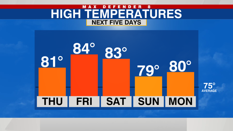
Friday could start out quite foggy, but the fog clears by the late morning and the warm up afterwards will be impressive. We reach the low to mid 80s Friday with plenty of sunshine and higher humidity.
Saturday starts out with the potential for fog and in the upper 60s. Expect a lovely warm up into the low 80s under partly cloudy skies.
The next cold front moves through early Sunday , unfortunately it looks much weaker than originally thought, meaning we won’t see much of a cool down behind the front. Expect a few early showers Sunday and a ever-so-slight cool down with lower humidity, Unfortunately for chilly weather fans, the afternoon highs remain above average.