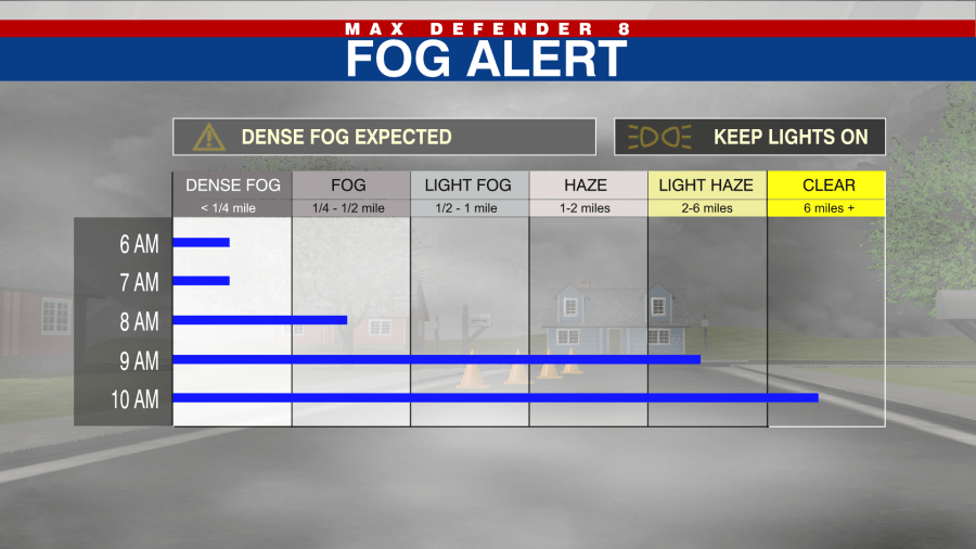
TAMPA, Fla. (WFLA) – This morning’s fog cleared slowly, but we did enjoy sunshine and afternoon temperatures touching the low 80s. Expect the warmth to fade slowly this evening, and as we slip into the cool mid 60s we will see dense fog forming again overnight.
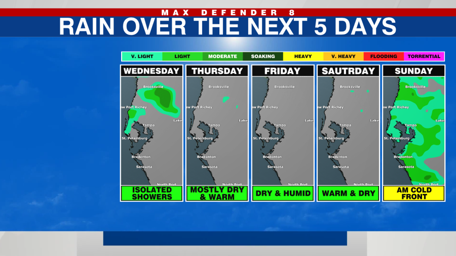
The fog slowly lifts between 9:30am and 10:30am, and we will still have a mix of sun and clouds through the day. Expect quite the warm up, to 83° for an afternoon high. There is a small chance for a few showers, mainly in our northern counties during the mid day to later afternoon. Those chances for showers are ahead of a cold front that will stall out before it reaches us. We will be fog prone Wednesday night into Thursday morning.
Thursday begins in the mid to upper 60s with reduced visibilities thanks to widespread fog. Once the fog lifts we will warm up quickly into the mid to low 80s under partly cloudy skies. There is a 10% chance for a stray showers, primarily to the north of I-4.
We continue warming up with highs in the low-mid 80s through the end of the week. Humidity increases as well. Finally, a strong cold front passes Sunday with a 30% chance of showers. Behind this front, it will be back to typical December day with highs in the 70s.