TAMPA, Fla. (WFLA) – We’re still tracking some isolated gusty showers around for this evening and tonight – but thankfully nothing like the severe weather and isolated tornadoes that we experienced from Tropical Storm Nestor.
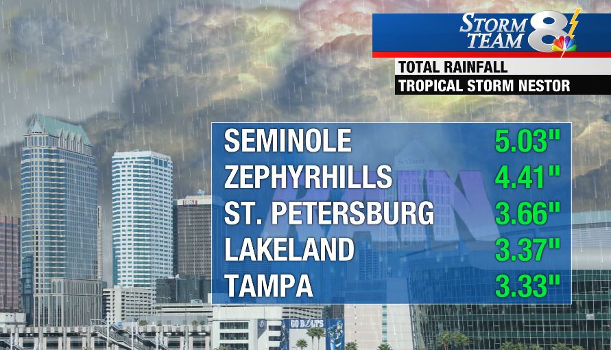
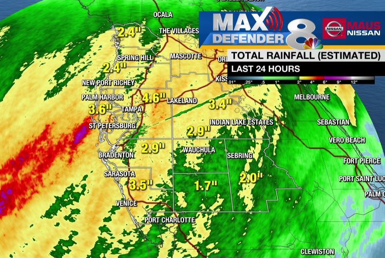
Nestor, now a post-tropical storm, will race across the Southeast and the Carolina’s tonight and Sunday with gusty winds and heavy rain. Most of the Tampa Bay area picked up a good soaking of needed rainfall.

Tampa International Airport only received about an inch and a half of rainfall in the ENTIRE month of September. More than double that amount fell Friday and Saturday alone.

The forecast for the second half of the weekend looks a whole lot better. Drier air will filter in over the course of the day. We’ll see some extra clouds and likely some spotty showers into the early afternoon. Sunshine will break out over the course of the day allowing high temperatures back p into the middle and upper 80s.
Deeper moisture will build back in early in the work week with rising afternoon rain chances.
IN THE TROPICS: No new development is expected in the next five days.

