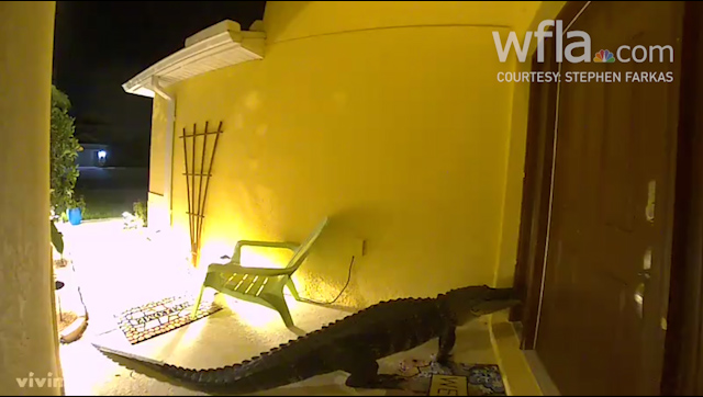
TAMPA, Fla. (WFLA) – Severe storms moved through our area this morning, between 5a.m. and 9a.m. We saw a line of showers and storms moving onshore from the Gulf. This line had a few severe thunderstorms and produced one tornado. The tornado formed to the south of our area, near Fort Myers. The National Weather Service confirmed it was an EF-1 tornado with 95 mph winds. The tornado damaged several homes and caused one injury due to broken glass. The tornado’s path was a little over a mile long and 50 yards wide. There were also multiple reports of wind gusts and damage throughout our area, including several damaged trees.
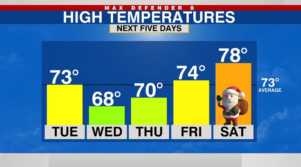
The rain ended rather quickly by the mid day. We saw peeks of sunshine through the clouds and temperatures hovered in the low 70s with occasionally gusty winds.
Tonight turns chilly, despite the mostly cloudy skies. Overnight low swill sink down into the mid to upper 50s.
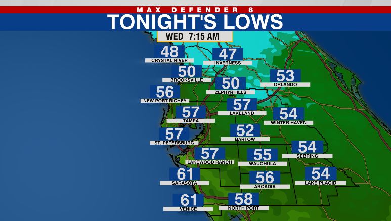
A few sprinkles are still possible early tomorrow morning, but then the skies clear out for the rest of the day. Highs only reach the upper 60s tomorrow despite the sunshine. It stays cool and breezy. The coldest night of this cold snap will be Wednesday night with lows sinking down into the upper 40s to near 50 degrees.
For Christmas Eve, it should be quite pleasant. It starts out in the low 50s, but temperatures climb all the way into the mid 70s by the afternoon with mostly sunny skies. It should be warm and sunny for Christmas with highs in the upper 70s.
You’ll notice a lovely drop in humidity as our temperatures cool down. The crisp feeling in the air lasts through the week, but by the weekend our dewpoints are climbing back up to more normal levels for us this time of the year. The humidity is back in full force by next Monday.
he dry conditions continue into next week with afternoon temperatures warming into the low 80s under partly cloudy skies.