TAMPA, Fla. (WFLA) – Temperatures climb quickly into the mid 80s this afternoon. The record high for today is 85 set in 2001, so most of us will be close to that record.
Expect a few passing clouds through the day, but the rain chance remains at just 10% in the afternoon and early evening. Overnight lows stay mild in the mid 60s.
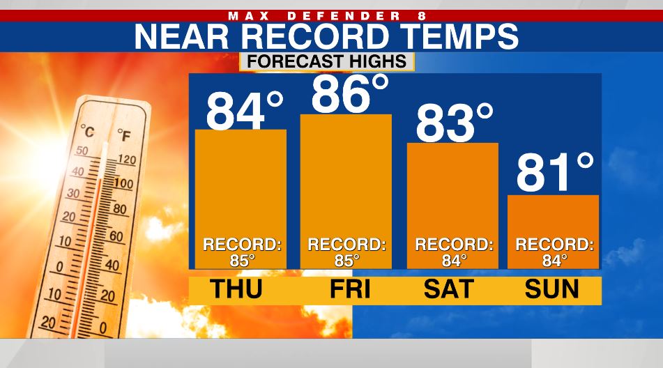
We may break the record high tomorrow. The forecast high is 86, and the record highs is 85. We stay in the low 80s through the weekend with a few showers possible on Sunday.
Finally a storm system begins to develop and head our way on Monday. The rain chances goes up to 30% Monday, and the best chance to see showers comes Tuesday as the system passes over the state.
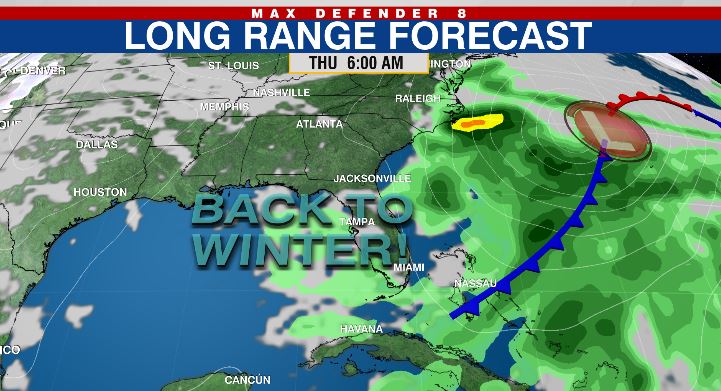
Behind that cold front, winter air returns. Highs return to the low-mid 70s, which is “normal” for this time of year.