TAMPA, Fla. (WFLA) — Temperatures were a little cooler this afternoon due to the clouds not breaking and clearing out quickly but otherwise it will still an above average day. It will stay warm through the overnight hours and low clouds could redevelop for Wednesday morning.
The clouds will clear and temperatures will warm into the low to mid 80s in the afternoon. There is a 10% rain chance for a few of those stray showers inland but most spots will stay dry.
The warm and dry pattern will persist through the end of the week with temperatures approaching record highs each day.
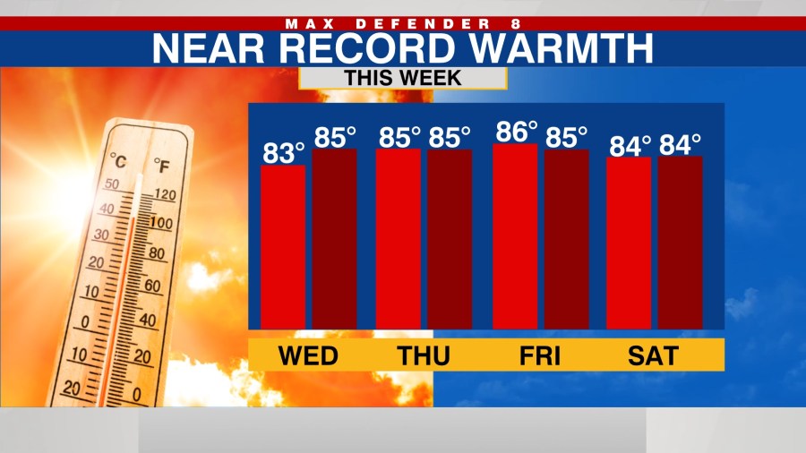
A few more showers are possible Saturday and Sunday but a washout is not expected for the weekend.
A cold front will approach next week and increase rain chances Tuesday. The long-range forecast models show this front bringing temperatures down for the middle of next week but a significant cool down is not expected. Highs will be in the low to mid-70s, closer to average for this time of year, before warming back up.
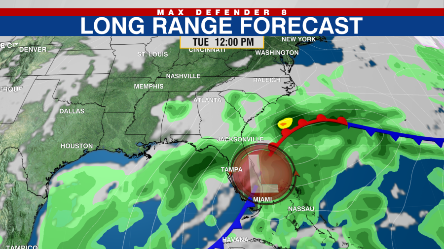
This front will need watched closely as forecast models can change and back off on the strength of it, like they did the last front.